There is so much to love about our splendid stretch of Highway 1, and the ocean’s influence is the common thread. Vast and teeming with life, the Pacific Ocean impacts nearly every part of life on the Central Coast, from wildlife to wine. But if not for the protection of the Monterey Bay National Marine Sanctuary, this landscape might not be so pristine or majestic.
At 6,094 square statute miles, the Monterey Bay National Marine Sanctuary covers an area larger than that of Yellowstone National Park. It stretches from Marin at the north into Ragged Point, San Simeon and Cambria at its southern end, covering 276 miles of coastline. (Note: The Monterey Bay National Marine Sanctuary is often confused with the city of Monterey or Monterey County. But the MBNMS covers nearly a quarter of California’s coastline, including much of San Luis Obispo County’s stretch of Highway 1.) From north to south, from its surface to its deepest point two miles below, the MBNMS remains one of America’s greatest treasures.
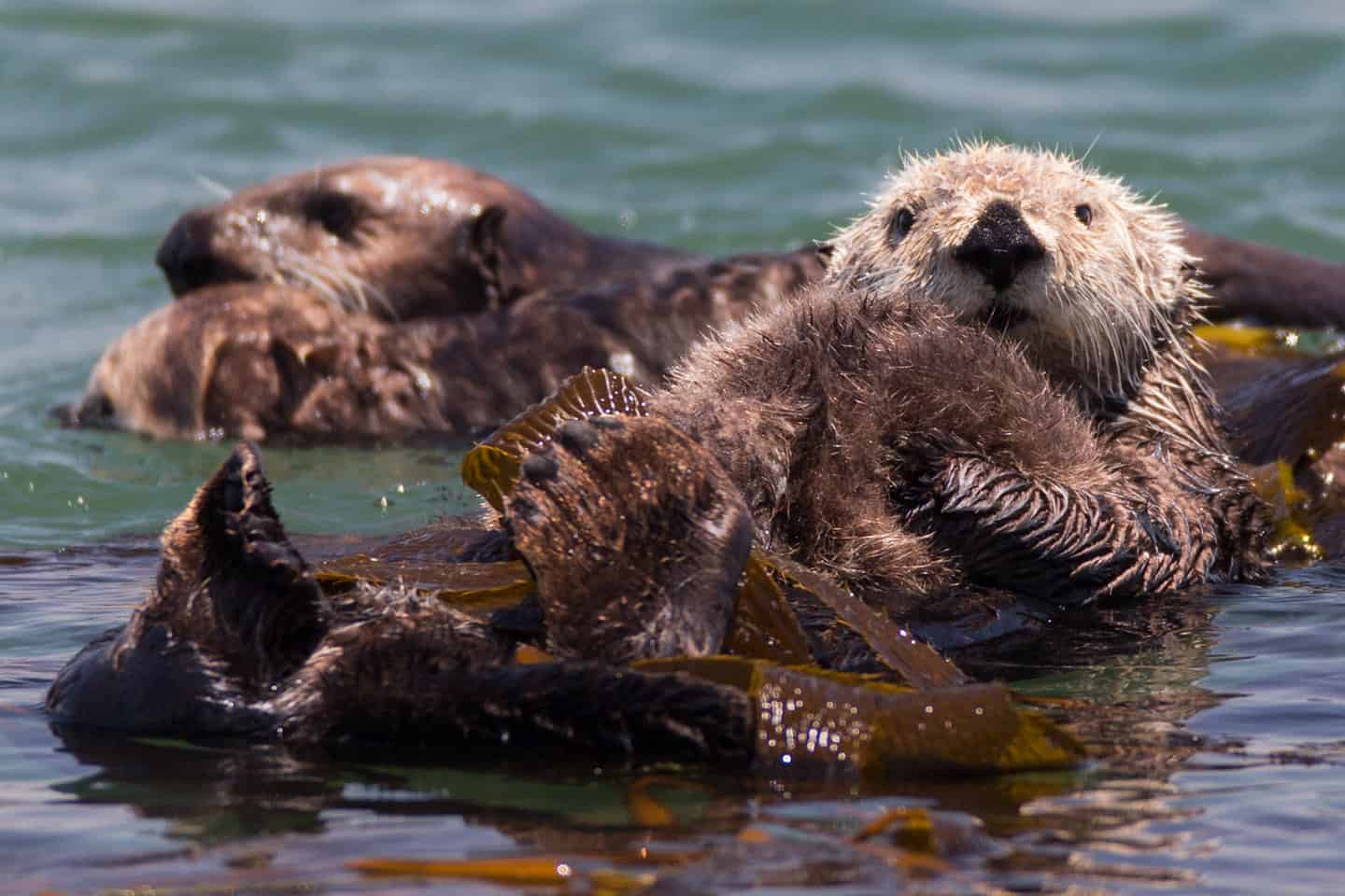
Fortunately for those traveling Highway 1 south of Big Sur, it’s also one of the easiest national treasures to access. Bejeweled tide pools, thick kelp forests, towering underwater cliffs and some of Earth’s richest and most diverse wildlife characterize the sanctuary. Sadly, it wasn’t always so. This area saw over a century of unchecked plundering, from whales and otters to elephant seals, abalone and sardines. All of these species suffered depletion and near-extinction when ravaged by whalers, fur traders, fisheries and other industries.
In 1992, the Monterey Bay National Marine Sanctuary was established for conservation, research, education and public use. The protection of the MBNMS allows threatened species to re-establish in the delicate ecosystem, earning the area its nickname, “Serengeti of the Sea.” These include 36 marine mammal species, 180 bird species, 525 fish species, 4 turtle species, and 450+ algae species. It is a remarkably productive deep-ocean environment, for wildlife and for humans. Regulated commercial and sport fishing, diving, boating, surfing, and kayaking happen right alongside otters, sea elephants, dolphins and whales. Production that harms the environment, however, like seabed mining, oil drilling and ocean dumping are strictly forbidden.
Venture to the south end of the Monterey Bay National Marine Sanctuary to discover this priceless shoreline treasure. Try sailing, fishing, or kayaking in San Simeon, swimming the waters of Black Swift Falls off Ragged Point, or whale watching in Cambria. Wherever you go, the pristine beaches, tide pools, kelp forests, wildlife, and more will bring you right to the heart of Highway 1. To fall in love with the MBNMS, discover resources like the Whale Trail, the Coastal Discovery Center, and seaweed foraging tours. These and many more opportunities for eye-opening moments can be found on our Stewardship Travel For Good list.
Explore the Monterey Bay National Marine Sanctuary
Visitors Center: Coastal Discovery Center in San Simeon
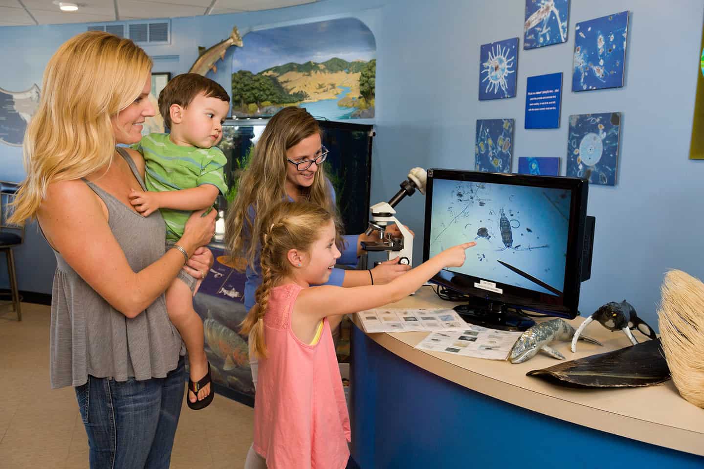
The Coastal Discovery Center is a collaborative research and education center established by the Monterey Bay National Marine Sanctuary and California State Parks. It represents the southern gateway to the Monterey Bay National Marine Sanctuary, and it is open to the public. Here, you’ll find exhibits, events, and hands-on activities that bring the rich connection between sea and shore to life. Learn about the history of San Simeon, from the native Americans to whalers to famous newspaper tycoon William Randolph Hearst and his “castle.” Explorers young and young-at-heart can also learn about the diverse wildlife nearby, including seabirds, elephant seals, and tidepools. See a Delta Submarine in person and learn about how technology has helped discover 1300+ shipwrecks offshore. Additional exhibits on watersheds, conservation and more can be found in this fascinating boutique marine museum. Find the Coastal Discovery Center in Old San Simeon at Hearst State Beach by the pier, across Highway 1 from Hearst Castle. Note: For another MBNMS Visitor Center, head to the Sanctuary Exploration Center in Santa Cruz, just steps away from the Santa Cruz Wharf.
Marine Protected Areas
Several smaller protected marine areas lie within the borders of the Monterey Bay National Marine Sanctuary.
Cambria State Marine Park
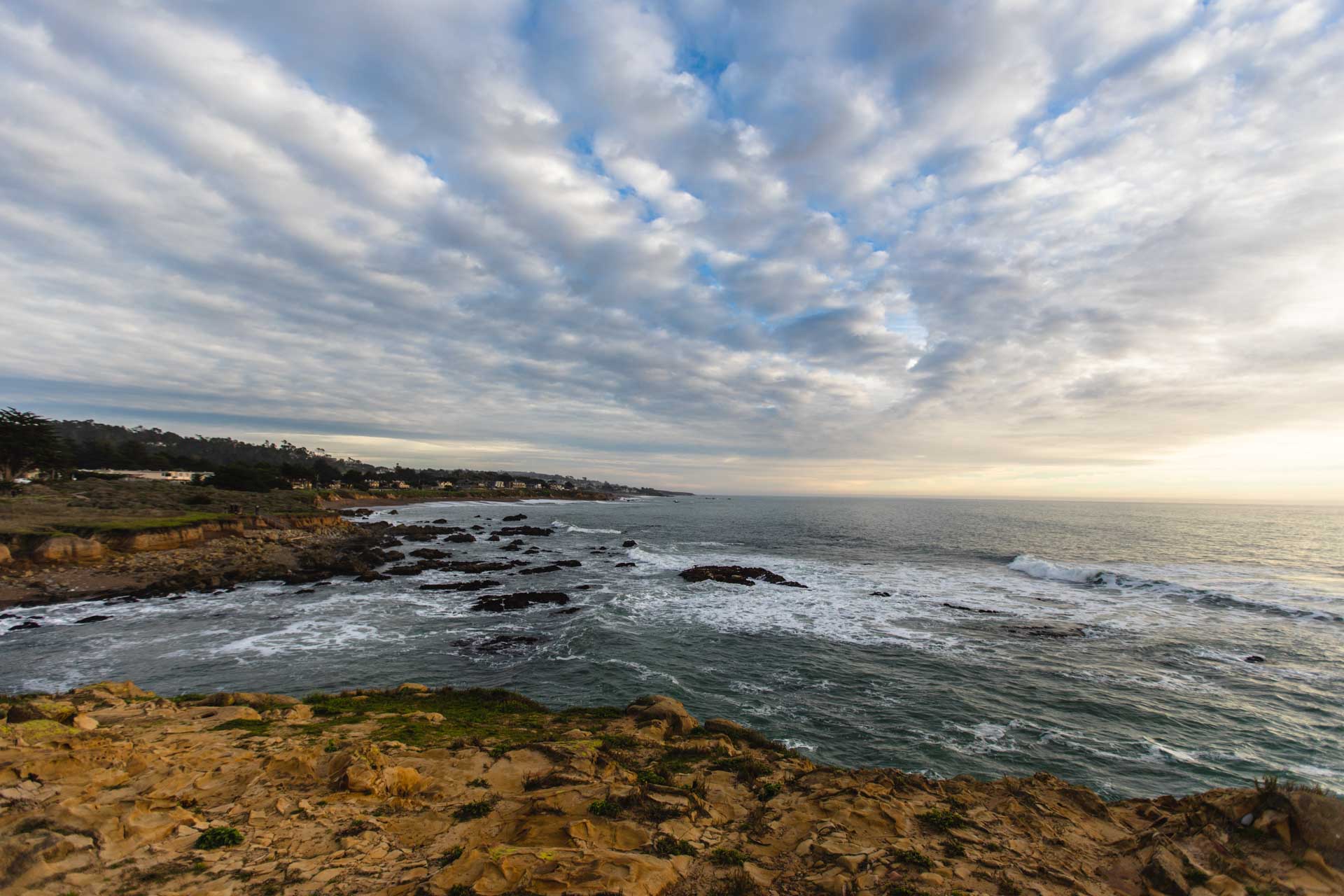
One of the best ways to enjoy this state marine park is by surfing the Pico Creek and Moonstone Beach surf spots. These beaches comprise the approximate north and south boundaries of the Cambria State Marine Park. Find excellent waves and coastal access here, as well as many fine walking trails. You can even use the boat ramp at Moonstone Beach to launch a kayak or standup paddleboard. Wherever you go, you’ll discover wildlife like sea otters, seals, sea birds and more, as this is considered a destination for nature enthusiasts. Visitors hike, scuba dive, snorkel, kayak, and fish recreationally here. (Note that a fishing license is still required, and all take regulations apply.) To experience the Cambria State Marine Park, drive Highway 1 to Windsor Boulevard in Cambria and head west to Moonstone Beach. Alternatively, drive to “new” San Simeon on Highway 1 and turn west onto Pico Avenue for the Pico Creek surf spot.
White Rock State Marine Conservation Area (SMCA)
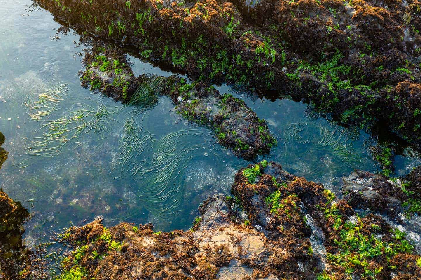
This state-protected area stretches from Cambria State Marine Park south to the coastline off Harmony. Be sure to bring your camera for shots of wildlife, wildflowers, and waves as this is a picturesque slice of coastline. This is also the location for the University of California Natural Reserve. Here, marine biologists conduct ongoing research to improve our understanding and protection of the ocean. In particular, scientists measure the value of preserving lush kelp forests and the vitality of intertidal zones. To reach the White Rock State Marine Conservation Area, head to Cambria, 33 miles north of San Luis Obispo on Highway 1. Just before reaching town, turn left on Ardath and continue to drive west for 1.3 miles. Turn left on Marlborough Lane and park at Lampton Cliffs Country Park. Here, you can access a number of trails that cross the bluffs overlooking the SMCA. Note that fishing of any kind is not allowed in the White Rock State Marine Conservation Area.
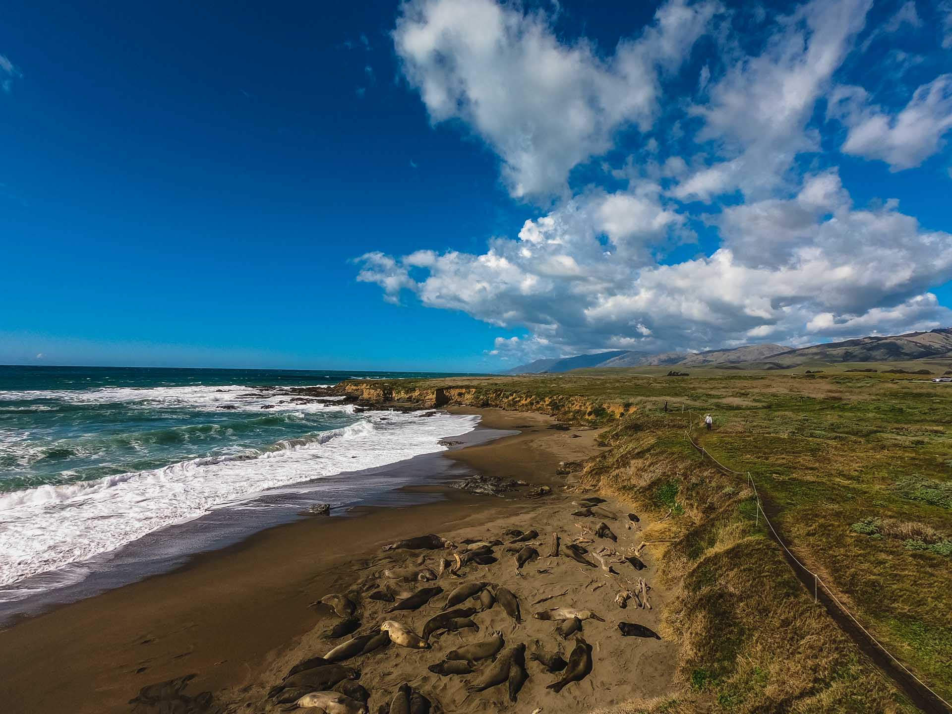
Piedras Blancas State Marine Conservation Area (SMCA) and Piedras Blancas State Marine Reserve (SMR)
These two areas sit side-by-side parallel to the coastline offshore from San Simeon. Both lie in the nine miles between Arroyo De La Cruz at Point Sierra Nevada and Arroyo Laguna near San Simeon. The SMR butts up to the coast, while the SMCA lies further offshore, beyond the kelp beds, accessible only by boat. Visitors to the SMR will notice it is centered on the historic Piedras Blancas Lighthouse, built in 1875. Booking a walking tour of the lighthouse is the best way to see the scenic state marine reserve. Access to the light station grounds is by guided tour only. Another ideal viewing area sits just south of the entrance to the lighthouse, at the Elephant Seal Rookery. Whether you tour the lighthouse or watch the life cycle of the elephant seal, you’ll get to experience the best of this conservation area. The free lot at the Elephant Seal Rookery is an ideal place to park. Find it about 13 miles miles south of Ragged Point or 6 miles north of Hearst Castle on Highway 1.
Davidson Seamount
Beneath the surface of the Pacific Ocean stands a massive yet extinct volcano called the Davidson Seamount. This underwater goliath lies 75 miles west of San Simeon, Ragged Point and Gorda, stretching 26 miles long and 8 miles wide. As for depth, the Davidson Seamount stands nearly 1.5 miles tall, but its crest is still three-quarters of a mile beneath the ocean’s surface. The richly diverse biological area comprises 237 species and over two-dozen types of deep-sea coral. Called “An Oasis in the Deep,” it boasts coral forests, crabs, shrimp, broad sponge fields, and many rare and unidentified deep-water species. In fact, recent research has uncovered what’s called “The Octopus Garden,” where thousands of female octopus brood. Wedged into the nooks and crannies of a volcanic outcrop, these octopus guard their eggs and incubate them in the hydrothermal waters. To discover more about these marvelous deep-sea creatures, see the short film from the National Marine Sanctuary Foundation called “Discover Wonder: The Octopus Garden.” As a pristine biological undersea area, the Davidson Seamount provides critical insight for marine conservation, education, history, and ecology. Adopted into the Monterey Bay National Marine Sanctuary in 2009, the Davidson Seamount has only been explored by six expeditions. On those trips, scientists discovered over 60,000 species on the seamount, with about seven percent endemic to the area. These are cold waters: even at the summit of the seamount, the water temperature is just over freezing at 36 degrees F. As of yet, the Davidson Seamount is unreachable by any commercial or public means.
Watch Discover Wonder: The Octopus Garden
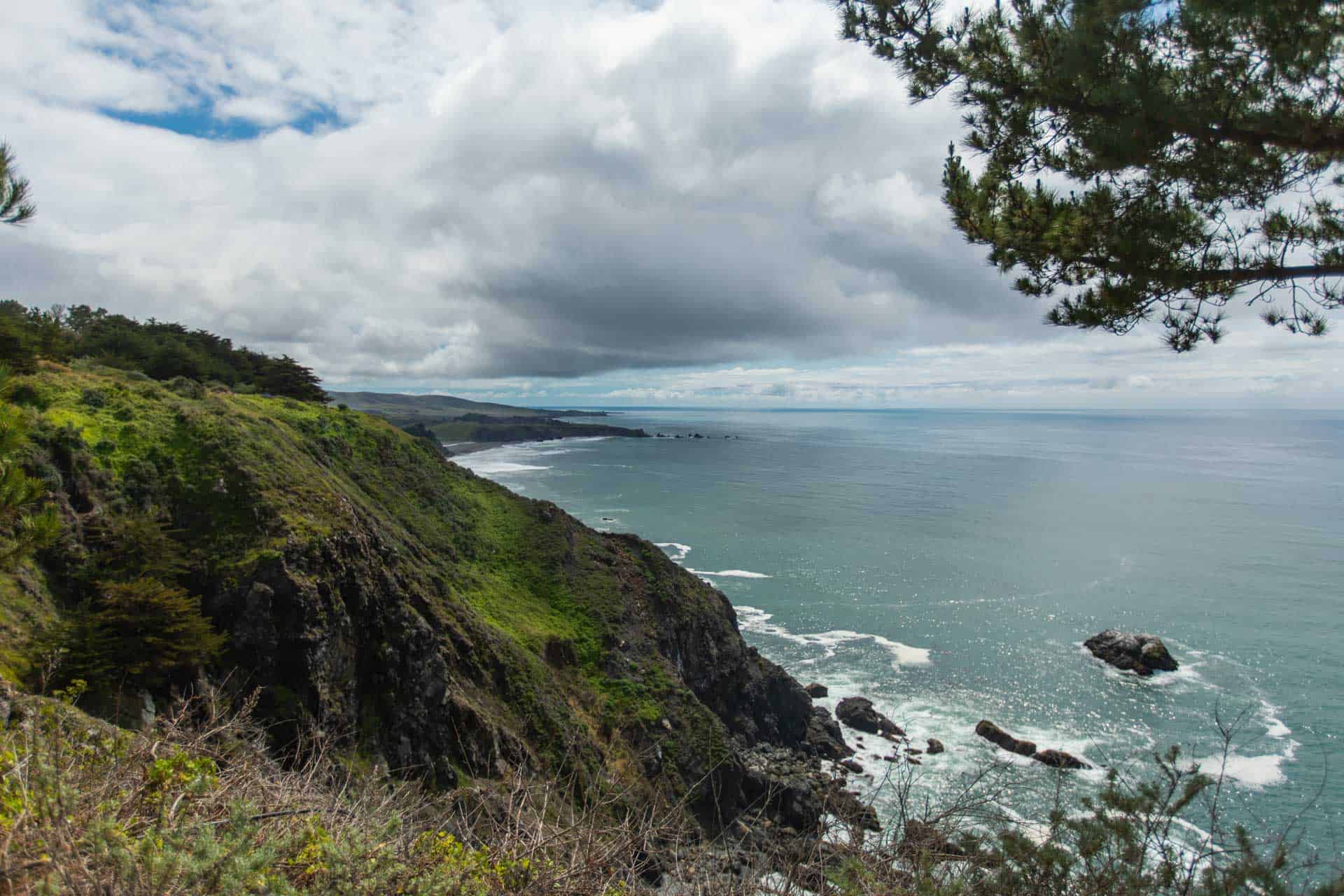
Big Creek State Marine Conservation Area and State Marine Reserve
These two areas lie within the Monterey Bay National Marine Sanctuary, extending westward from the Big Sur coastline north of Ragged Point. Together, the SMCA and the SMR fit together to form a large J shape along the shoreline. (The SMCA is offshore, not connected to land, and the smaller of the two areas.) The boundaries for this state- and federal-protected sanctuaries are, at the north end, Vicente Creek, and Lime Creek at the south, with Big Creek at the center. According to the lucky ones who’ve seen it, Big Creek is the most beautiful creek on the Central Coast. But because it is part of a University of California reserve, it is closed to the public. Of course, you can see where it meets the Pacific if you have a boat and aren’t concerned about Big Sur’s towering sheer cliffs. See the Big Creek State Marine Reserve from one of the Highway 1 turnouts near Julia Pfeiffer Burns State Park or Limekiln State Park.
Point Sur State Marine Conservation Area and Point Sur State Marine Reserve
These two sanctuaries sit side-by-side against the Big Sur shoreline between northern Point Sur and southern Cooper Point. (This is at the southern end of Andrew Molera State Park.) The SMR is the offshore area of the two, while the SMCA comprises the coastline and intertidal zones. Point Sur was famously treacherous for passing seacraft, and the northern side of the point wrecked many, many ships. Hence the establishment of the Point Sur Lighthouse, built in 1889 atop a rock 361 feet high. At such a height, the Point Sur Lighthouse provides excellent access for visitors to see the Point Sur SMCA and SMR. At the southern end of the sanctuary, take a walk out to the mouth of the Big Sur River in Andrew Molera State Park. At one mile in length, the path is a pleasant way to get to the point and catch beautiful views of the coast.