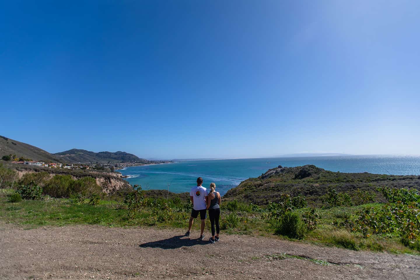
Hiking along the Highway 1 Discovery Route showcases the diversity of this abundant place. From Ragged Point to Nipomo, each corner of coastal SLO CAL has its own distinctive flora, fauna and history.
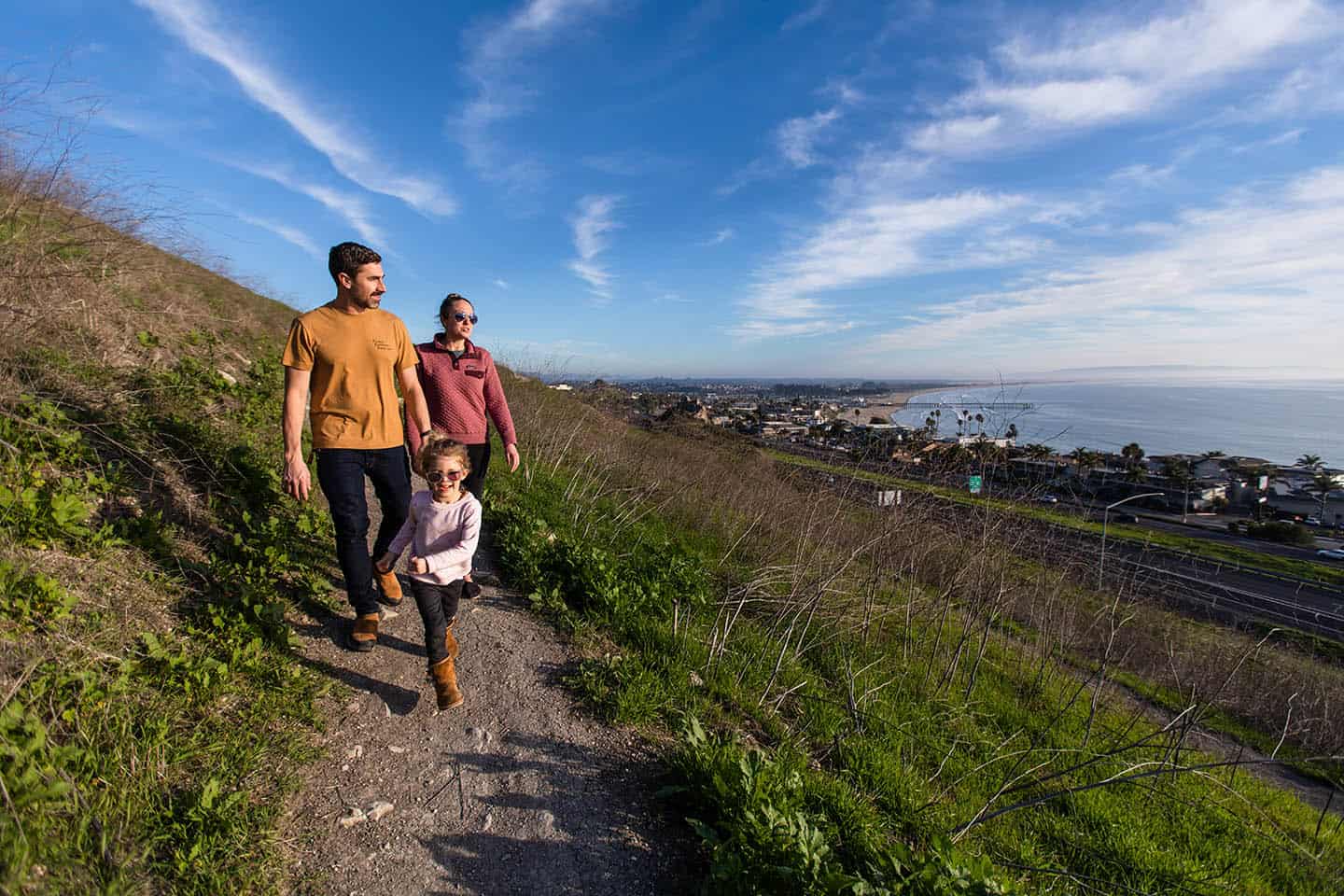
Visitors along Highway 1 have their choice of tucked-away mountain trails, walks along rugged coastline and expansive wine country views. Some hikes pass beside quaint cafes and historic sites while others feel remote and a world away. Some come with a soundtrack of crashing waves and others hum with bees and singing crickets. Whatever your mood, Highway 1 Road Trip has a hike to suit it.
Safety note: For even the tamest of hikes, be sure to bring water, a hat, sunscreen, ID, keys, your mobile phone and a friend. Also bring cash (some trails charge a small fee). Be sure to also remove all valuables from your vehicle at trailheads.
Read below to learn about all the hiking options on yourHighway 1 Road Trip.
HIKING HIGHWAY 1
Ragged Point Hiking Trails
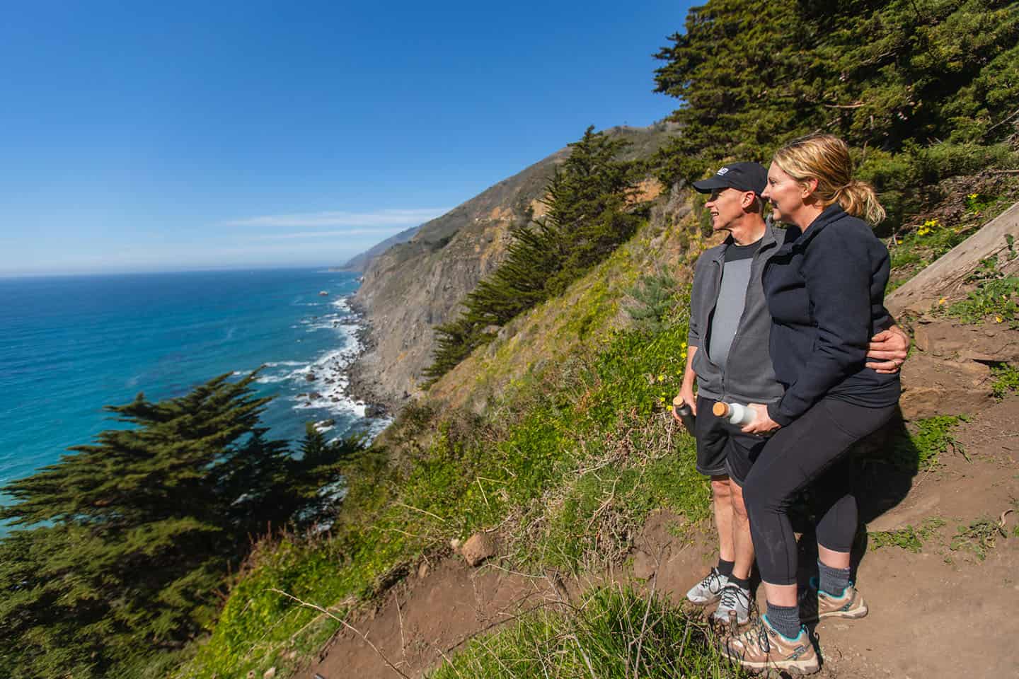
Ragged Point hiking trails are some of the most scenic along Highway 1. Showcasing breathtaking ocean views and secluded waterfalls, you’ll enjoy what makes this slice of California coastline so iconic. Known for a mild climate with foggy mornings that burn off by the afternoon, some trails can be slippery when wet (do wear proper footwear). The best part about hiking Ragged Point? Trails range from easy flat-land nature walks to steep and challenging cliffside hikes. Choose your own adventure and discover the magic of Ragged Point, also known as “The Gateway to Big Sur.”
Black Swift Falls Trail
Steep cliffs and breathtaking panoramas mark this classic Ragged Point hike. Short and sweet, the trail measures less than 1 mile long, but descends (and ascends!) 400 feet in elevation. A narrow path of switchbacks leads to a small black sand beach fed by a seasonal waterfall. Bring grippy hiking shoes for this landmark hike, and enjoy the towering ocean views.
Fire Road Trail
Sweeping coastal views and a well maintained, graded road characterize this trail, found just across Highway 1 from Ragged Point Inn. Up and back, this 4-mile, 1700-foot-gain trail makes for an excellent scenic workout.
Salmon Creek Falls
With its 120-foot waterfall and easy trail access, Salmon Creek Falls is a short hike just off Highway 1 at Big Sur’s southern end. For a longer walk, take the trail to its end 6.5 miles in.
Hiking all of Ragged Point
Click here to learn more about Ragged Point hiking and access a breakdown of each hiking trail available in the area. No need to wonder which is best for you or your family: We’ve collected all the necessary information on trailhead location, difficulty level and nearby points of interest. All you need to do is lace up your hiking boots and hit the trail.
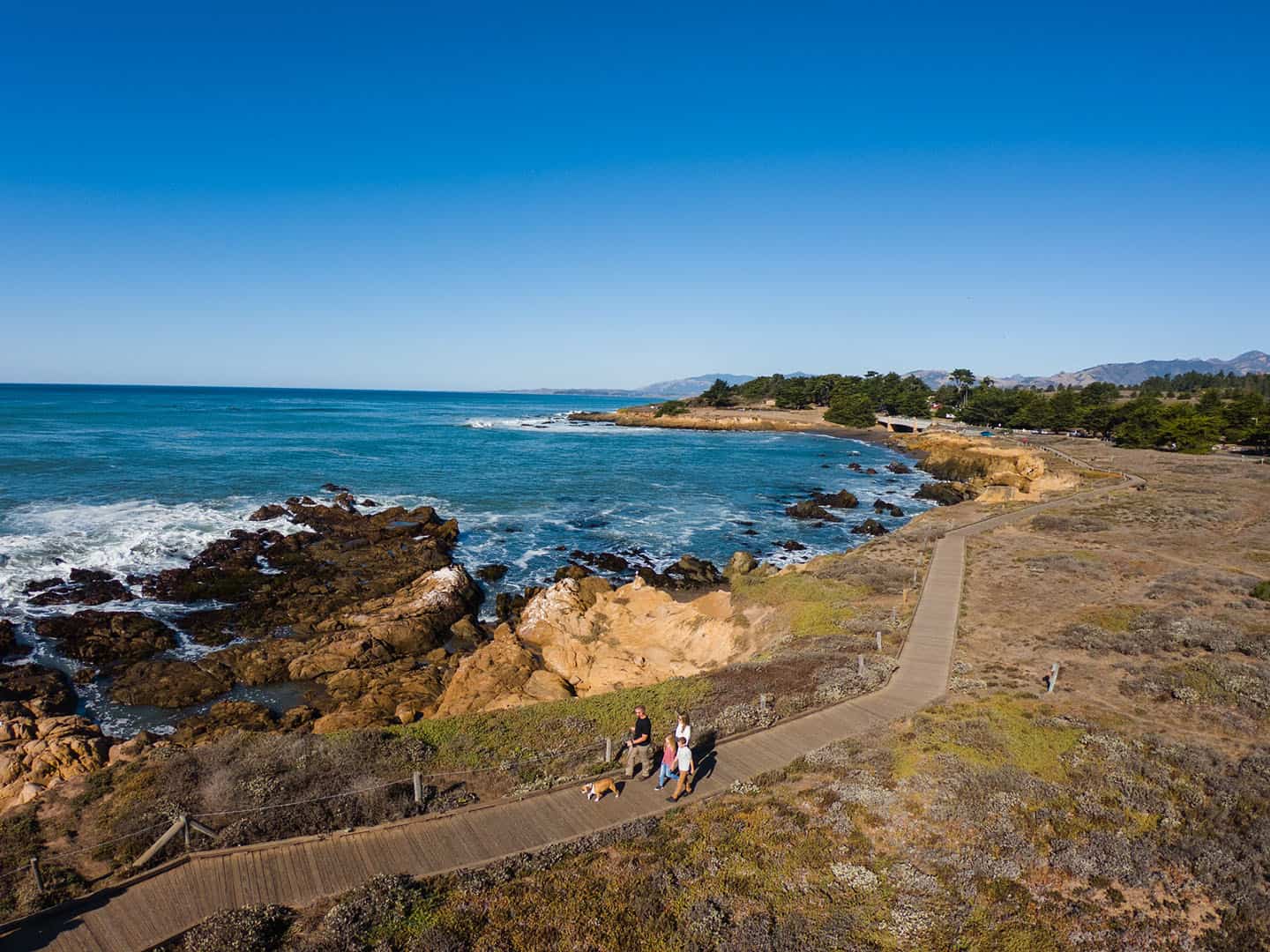
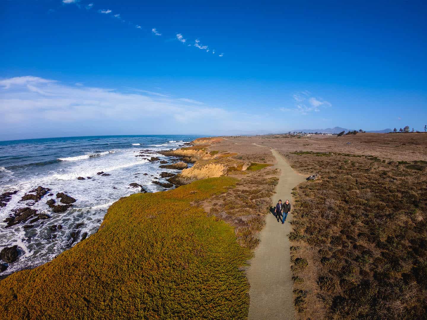
San Simeon Hiking Trails
San Simeon hiking trails offer windswept vistas and exciting wildlife viewing opportunities along Highway 1. Known for a cool and foggy climate with light winds rustling into the afternoon, you’ll want to grab a jacket before heading out. Looking for accessible coastal trails perfect for the whole family to enjoy? San Simeon hiking trails are mostly easy-to-moderate in difficulty and all offer ocean views.
San Simeon State Park
This 3.3-mile trail skirts sections of the San Simeon Natural Preserve and Washburn Campground. Look for coastal vista points, benches and interpretive signs about local wildlife, flora and fauna. Note: the trail section that skirts the seasonal wetland is wheelchair accessible.
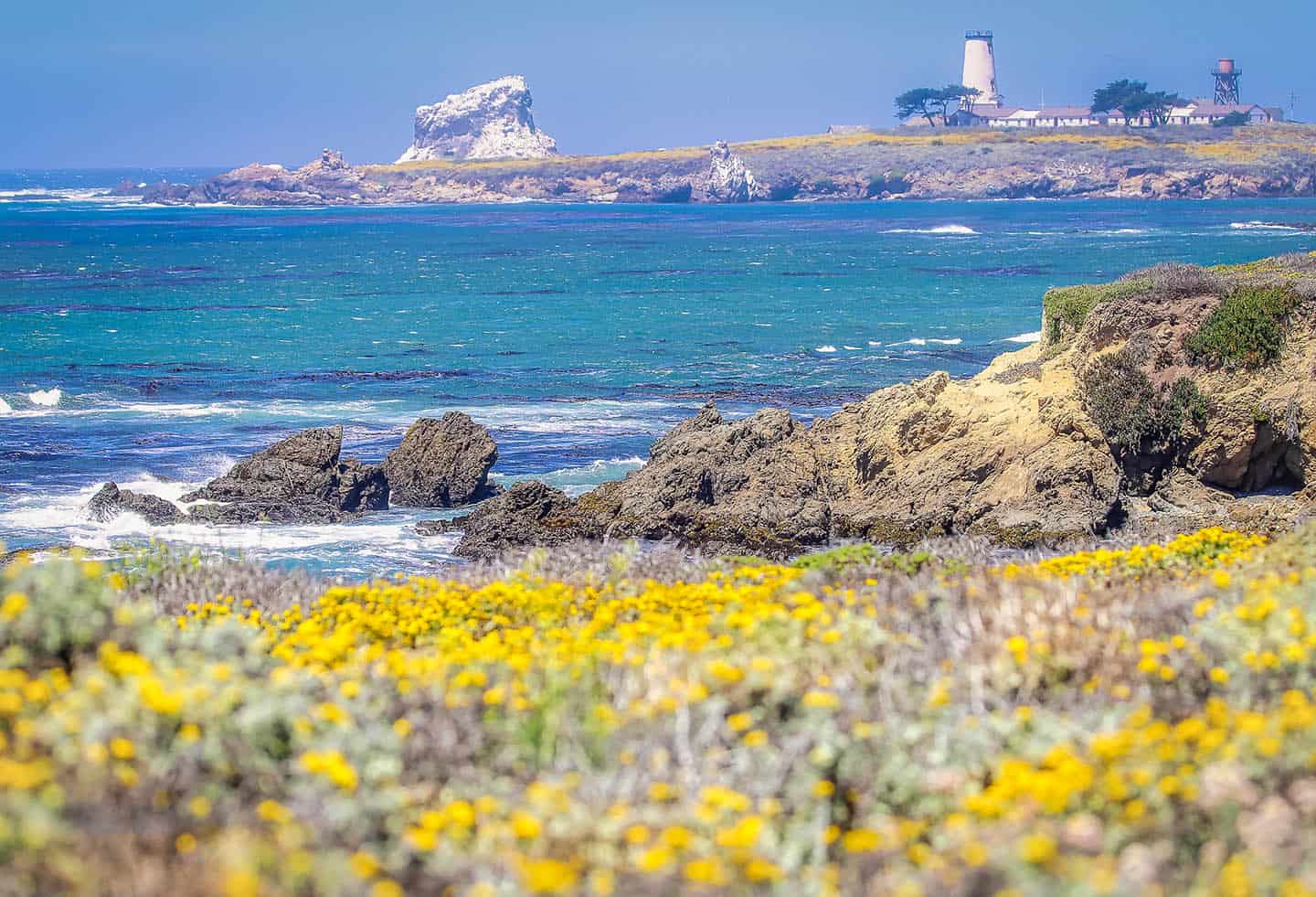
Piedras Blancas, Boucher Trail
In just under 2 miles, this varied and interesting trail winds over coastal bluffs, grassland and wetland areas. Beginning at the paved elephant seal viewing parking, the trail ends a half mile north of the Piedras Blancas Light Station.
San Simeon Cove
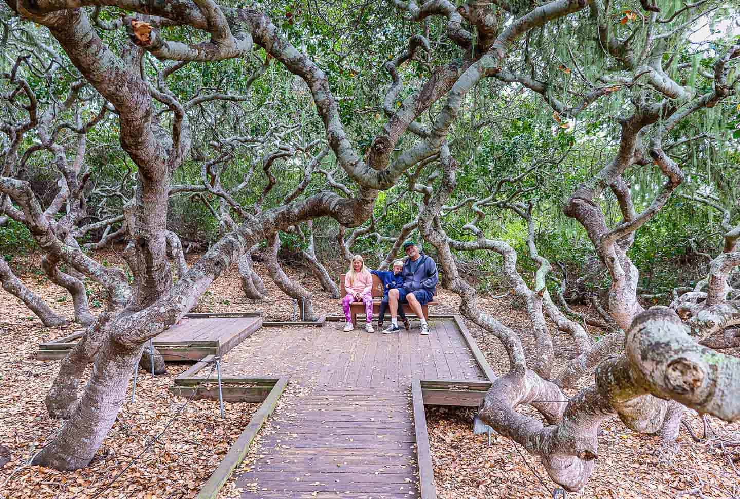
Hiking San Simeon Cove belongs on any California dreaming bucket list. Find the trailhead by climbing the bluff at the north end of the cove. Then travel through a magical forest on the bluffs above the beach. Spanish moss hangs from eucalyptus, pine, cedar, and cypress trees along the way. At the end of the peninsula, a half-mile in, the cove sparkles against breathtaking views of rock formations on the beach.
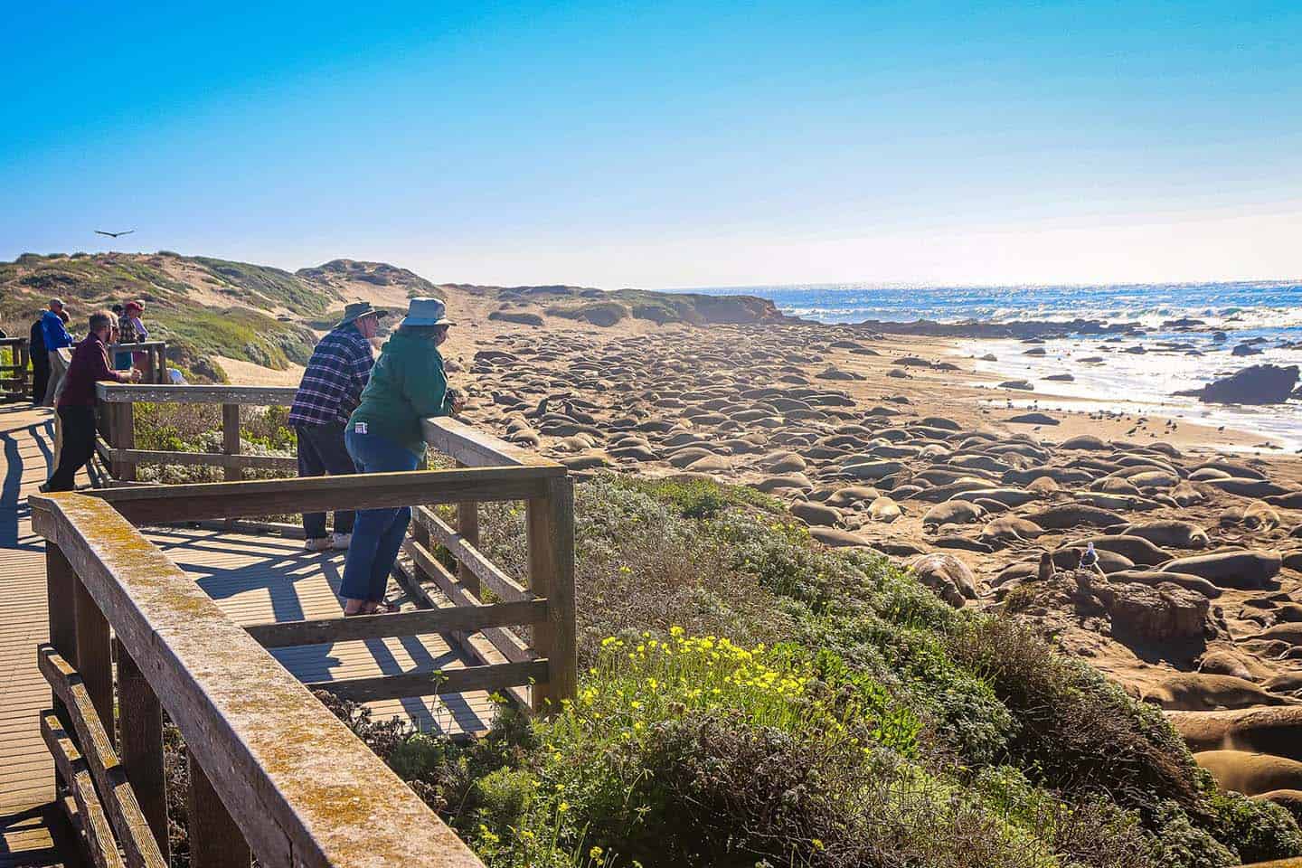
Elephant Seals
The viewing boardwalks at the Piedras Blancas Elephant Seal Rookery comprise a section of the California Coastal Trail. Short, flat, and easy to walk, these boardwalks are also wheelchair accessible with terrific views of the elephant seals.
Junge Ranch Trail
This 2.2-mile out-and-back trail offers views of abundant wildflowers to hikers of all skill levels. Accessible all year long, the trail welcomes dogs on leash as well.
San Carpóforo Creek
The signs for this trail are hosted by the Los Padres National Forest, which owns a part of the wild, untouched beach at the end of the trail. Find a small parking area with a fence and gate on the north side of the Highway 1 bridge over San Carpóforo Creek. (The address of the house opposite is 18550 Cabrillo Highway, San Simeon, California.) The trailhead lies beyond the gate and leads to San Carpóforo Creek, which can sometimes be tricky to cross. But the reward for those who do is access to a remote sandy beach.
Hiking all of San Simeon
Click here to learn more about San Simeon hiking and access a breakdown of each hiking trail available in the area. No need to wonder which is best for you or your family: We’ve collected all the necessary information on trailhead location, difficulty level and nearby points of interest. All you need to do is lace up your hiking boots and hit the trail.
Cambria Hiking Trails
From towering pine trees to moonstones on the beach, you’ll find that Cambria offers up some of the most enchanting hiking opportunities along Highway 1. Trails are as approachable as they are beautiful, with easy-to-moderate difficulty (plus, many trails featuring ADA accessible boardwalks). Known for its cool and foggy climate, you can expect light wind to bluster through the afternoon. Dress accordingly and expect an epic day traversing the coast.
Moonstone Beach Trail
Cambria hiking at its most accessible and panoramic, this 2.85-mile out-and-back bluff trail features classic coastal scenery. Look for wildlife, explore tide pools on the beach, or admire the scenery from a comfortable bench. A large portion of this Cambria hiking trail includes the Moonstone Beach Boardwalk, making for a comfortable walk for all skill levels. Dogs can come, too! (Just remember to keep them on leash.) Find the trailhead at the beginning of Moonstone Beach Drive and hike northwest through the pines along Santa Rosa Creek. You’ll see the boardwalk begin after just 0.2 miles.
Fiscalini Ranch Preserve
One of the most breathtaking hiking trails near Cambria, this preserve once belonged to the Chumash and Salinian Native American tribes. Today, it is permanently protected from development, thanks to the American Land Conservancy and the local chapter of SWAP (Small Wilderness Area Preservation). This favorite 1-mile trail along the Pacific Ocean welcomes pedestrians, horseback riders, and bicyclists. It also protects the home of many endangered species, including red-legged frogs and Monterey pines. Completely ADA accessible, this trail is a reminder of what dedicated citizens can do to protect a precious space. At 437 acres, the preserve has multiple entrances. Consult this map for more detailed access information.
Fern Canyon Henry Kluck Trail
Another secluded Cambria hiking trail, this one passes through Fern Canyon, crosses Fern Drive and dead ends in a chaparral near Highway 1. At about 1.5 miles, this out-and-back easy hike showcases Cambria’s Monterey pines, oaks, ferns and a seasonal creek. To find the trailhead, head south on Highway 1 and turn right on Burton Drive. Make another right on Fern Drive and follow to the bottom of Fern Canyon. The trail marker is at the left.
Lampton Cliffs Park
One of the best short hikes near Cambria, this trail loops through a 2-acre park on the south edge of town. Toward the beach, stairs lead down to the rocks and crashing waves, especially dramatic during winter swells. At low tide, though, tidepooling becomes the activity of choice here. Find the trailhead at the intersection of Lampton Street and South Windsor Boulevard with a small parking lot.
Leffingwell Landing
With short hiking trails, Leffingwell Landing offers a beautiful lookout and access to a rocky shore with great tide pools. Visitors at the right time of year might be lucky enough to spot a whale or two. Find this special spot where Moonstone Beach Drive meets State Park Road in Cambria.
Strawberry Canyon Trail
One of the most secluded hiking trails in Cambria, Strawberry Canyon comprises a large, 1-mile loop. Peace and quiet characterize this walk, along a secluded trail beneath towering pines. To reach the trailhead from Highway 1 in Cambria, drive 0.75 miles south on Burton Drive until you reach Kay Street on the left. The trail is across the street, on the right side of Burton Drive.
Hiking all of Cambria
Click here to learn more about Cambria hiking and access a breakdown of each hiking trail available in the area. No need to wonder which is best for you or your family: We’ve collected all the necessary information on trailhead location, difficulty level and nearby points of interest. All you need to do is lace up your hiking boots and hit the trail.
Cayucos Hiking Trails
Cayucos hiking trails are a cinch to trek and full of enticing coastal surprises. With hikes that reveal sun-dappled tidepools and even a real-life shipwreck, you’ll never know what’s in store when hiking in Cayucos. Featuring cool, foggy mornings with radiant, clear afternoons, you’ll have little trouble enjoying the views along the way. Plus, Cayucos trails are easy-to-moderate in difficulty–unless, of course, you opt to veer off the beaten path.
Estero Bluffs
Part of the Estero Bluffs State Park, this easy 3-mile hike includes wide, flat trails through coastal rushes and panoramic views of Morro Bay and Morro Rock. To find the trailhead, take Highway 1 North past Cayucos. Pull into the rustic parking lot just past town on the west side of the highway. This is one of the best Cayucos hikes for a picnic!
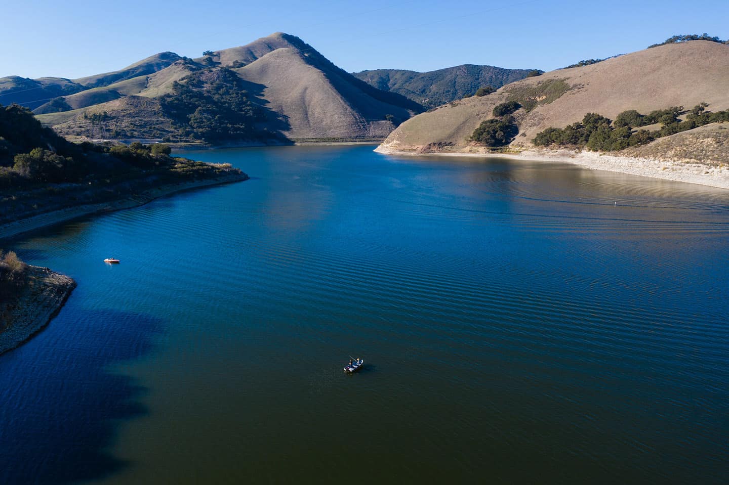
Whale Rock Reservoir
A few of SLO County’s best hikes with 360-degree views, the Whale Rock Reservoir trails runs out-and-back at a total of 4 miles long. Both travel through the 1,350-acre reserve, and are uncrowded and easy to walk. Bring dogs on leash, and watch closely for ticks and rattlesnakes. The best months for these hikes are during the dry season, April through November. Enjoy viewing wildflowers and bird-watching throughout. Get to the trailheads by driving south on Highway 1 from Cayucos. At Old Creek Road, turn left. Drive 1.5 miles and park on the left before reaching the PG&E substation.
Hang Glider Hill Trail
At 1 mile round trip, this trail can be hiked by just about anyone. Fans of hang gliding will enjoy watching people take off from here, with long views of the ocean as backdrop. To reach the trailhead, drive south on Highway 1 from Cayucos; turn left onto Ocean Boulevard, right on Haines Avenue, right on Davies Avenue and continue up the hill to the dirt road.
Harmony Headlands State Park Trail
A former cattle ranch from the 1800s, this land was purchased by the Land Conservancy in 2003 and deeded to California State Parks. Today, the easy 4-mile round-trip trail passes the historic ranch house and along coastal bluffs with views of the ocean. Be forewarned that dogs are not allowed on this trail. Find the trailhead 6.8 miles north of Cayucos on Highway 1, on the ocean side of the highway.
Hiking all of Cayucos
Click here to learn more about Cayucos hiking and access a breakdown of each hiking trail available in the area. No need to wonder which is best for you or your family: We’ve collected all the necessary information on trailhead location, difficulty level and nearby points of interest. All you need to do is lace up your hiking boots and hit the trail.
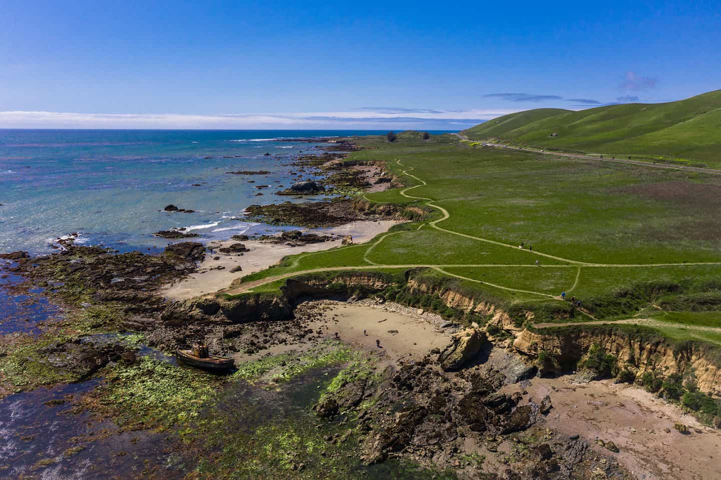
Los Osos & Baywood Hiking Trails
Los Osos and Baywood are a hiker’s playground on Highway 1. Featuring wildflower-covered mountains to pebbly beaches, you’ll encounter a wide breadth of terrain along your journey. The climate in Los Osos & Baywood is traditionally cool and foggy in the mornings with clear afternoons perfect for exploring cliffs and tidepools. Although trails are mostly easy-to-moderate here, you can also choose a more challenging hike (like the formidable Valencia Peak) depending on your skill level.
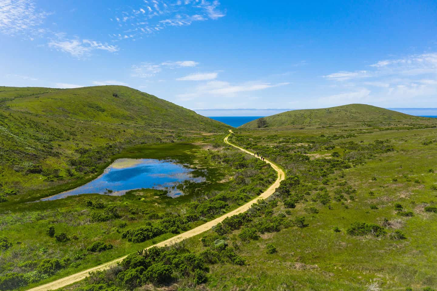
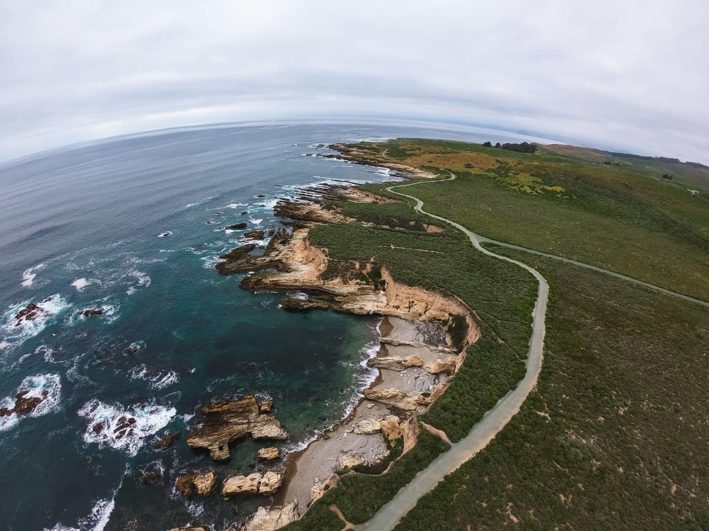
Montaña de Oro State Park & Hazard Canyon Reef
Located within Montaña de Oro State Park, Hazard Canyon Reef is a gorgeous beach with tide pools and scenic views. Take the 1-mile hike on the Dune Trail to safely access the mouth of the canyon. Walk through the 4-way junction, then between the dunes, and the trail will end at a rocky shore. Explore the tide pools for hermit crabs, sea stars, sand dollars and anemones. The trail is named after a prior landowner who planted eucalyptus trees in hopes of selling them as lumber.
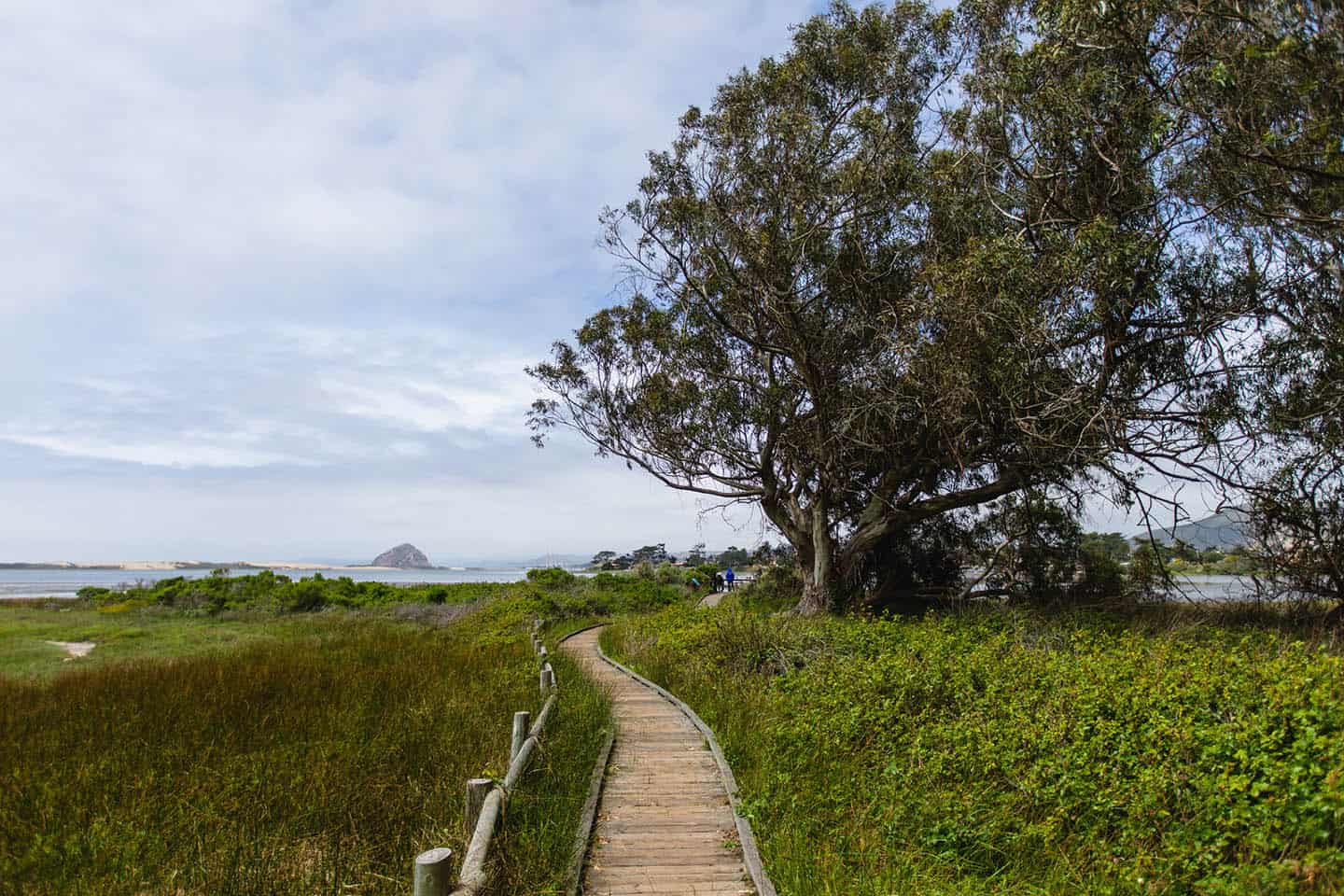
Audubon Sweet Springs Nature Preserve
This 24-acre preserve offers hiking trails and excellent views of Morro Bay and Morro Rock. Managed by the Morro Coast Audubon Society, the preserve is located on the north side of Ramona Avenue between Broderson and 4th Street. Trails lead among Monterey Cypress and eucalyptus to two freshwater ponds, and around a salt marsh to the edge of Morro Bay. Several threatened and endangered species of birds populate the preserve, and many shorebirds and ducks winter in the adjoining bay. From late October to March, Monarch butterflies also cluster here.
Black Hill Trail
Nine peaks between San Luis Obispo and Morro Bay originated as volcanoes beneath the sea fifteen million years ago. After the sea and volcanic explosions subsided, erosion began dissolving the softer mountain material around the volcanic rock. Nine volcanic peaks remain, including Hollister Peak and the famed Morro Rock.
Black Hill, the last peak in the series, offers a 0.6-mile trail with a little of everything: chaparral, eucalyptus, oaks, pines, and coastal shrubs. From the mountain’s 640-foot summit, you can view the Morro Bay Estuary, the sand spit, and the hills of nearby Montaña de Oro. Hikers looking for more can hike to the summit starting farther down Black Hill.
To find the trailhead, drive through the Morro Bay Golf Course, turning right at the first intersection and up the unmarked Black Hill Road. Follow 0.8 miles up the hill to the end of the road and park.
Bluff Trail
Inside Montaña de Oro State Park, this trail spans 3.4 miles round trip, passing coastal bluffs, tide pools, beaches and rocky coastline. The trailhead can be found across that of Valencia Peak, just near the visitor center. Start across a wooden bridge and then take in views of the sea, including Spooner’s Cove. Stop at Corallina Cove after a half mile or continue on for more rugged trail and Quarry Cove.
El Moro Elfin Forest
Adjacent to the Morro Bay Estuary, this 90-acre natural area belongs to San Luis Obispo County Parks and California State Parks. Foliage includes coastal brackish marsh, riparian woodland fringe, pygmy oak woodland, maritime chaparral, coastal dune scrub, and oak and manzanita. The Elfin Forest supports more than 110 kinds of birds, 22 species of mammals and 13 species of reptiles and amphibians. Chumash middens can also be found throughout the park.
A mile-long boardwalk loop provides access for young and old, walkers and wheelchair users, and protects the forest’s sensitive habitat. The Los Osos/Morro Bay Chapter of Small Wilderness Area Preservation (SWAP) removes invasive plants, provides erosion control, and conducts plant revegetation projects. SWAP also sponsors monthly third-Saturday nature walks and educational walks for local schools.
Quarry Trail
This 2-mile, moderately difficult loop trail lies on the east side of Morro Bay State Park. The Quarry Trail skirts the southern flank of Cerro Cabrillo, a 911-foot double-peaked ridge. The hike’s name refers to the rubble piles of an abandoned quarry site used for road construction in the 1950s.
Hiking all of Los Osos & Baywood
Click here to learn more about Los Osos and Baywood hiking and access a breakdown of each hiking trail available in the area. No need to wonder which is best for you or your family: We’ve collected all the necessary information on trailhead location, difficulty level and nearby points of interest. All you need to do is lace up your hiking boots and hit the trail.
Avila Beach Hikes
Sunny, scenic Avila Beach is the perfect meeting place for a family hiking trip. Here, the sun makes an appearance earlier than any other coastal hiking destination along Highway 1. Soak up the sunshine and embark on the Bob Jones trail, a paved, family-friendly hike leading from forest to sand. Want more of a workout? Go for the more demanding Ontario Ridge trail, a worthy challenge, indeed.
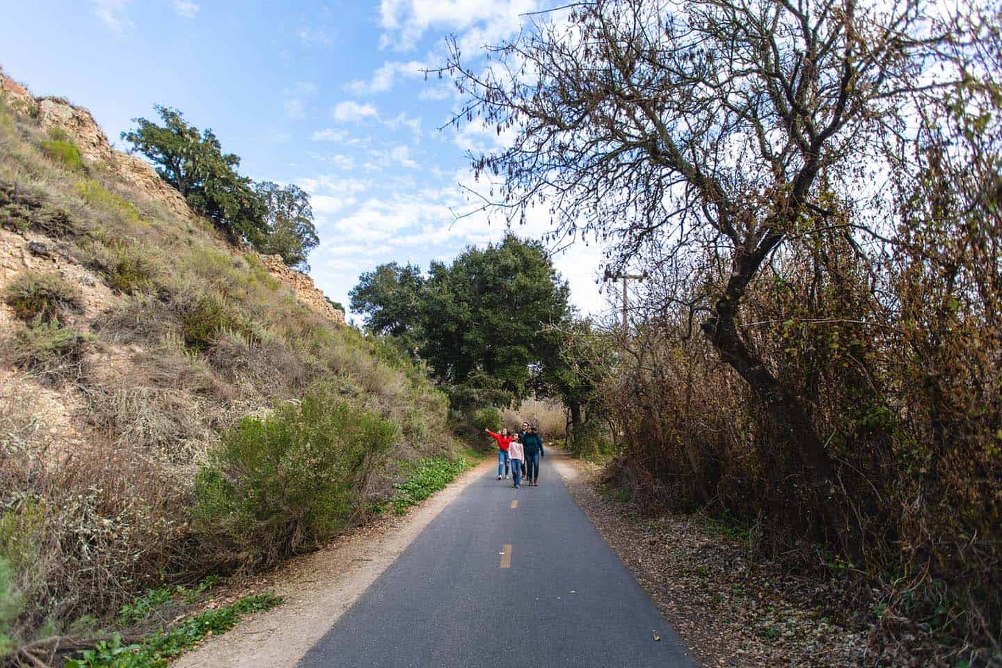
Bob Jones Trail
Of all the Avila Beach hikes, the Bob Jones Trail provides the leafiest, most family-friendly. Also called the “City to the Sea” trail, the paved path is popular as a hiking, jogging and biking route. The trail winds alongside San Luis Obispo Creek towards Avila Beach, stretching 2.5 miles each way. From the trail are views of bridges spanning the wide creek, the Avila Beach Golf Course, the town of Avila and the Pacific Ocean. You can even stop off at Woodstone Market for lunch or a snack along the route!
Mallagh Landing
Commonly referred to as Pirate’s Cove, the Mallagh Landing name is more accurate given the history of the land. In 1849, David Mallagh came to California as a sailing captain and built a small wharf and an adobe nearby. The Mallagh home can still be found under the hills of Ontario Grade. Mallagh Landing offers a hike near Avila Beach with scenic views of the coastline and Port San Luis Harbor. The route from the harbor to the landing is popular with kayakers. The hike over land is 9.3 miles, but is considered easy and can be done in about 3 hours. Both the walk and the bird watching are worthwhile.
Ontario Ridge Trail
One of the most scenic Avila Beach hiking trails, this 4-mile trail travels over a steep ridge above Shell Beach. For spectacular ocean views, start at the Shell Beach trailhead or at Cave Landing in Avila Beach and hike the full loop. Coastal sage surrounds the steep, rugged trail, passing views of Mallagh Landing, Avila Valley, San Luis Obispo, and Shell Beach.
Pecho Coast Trail & Rattlesnake Canyon
The Pecho Coast Trail comprises 3.75 miles round trip along a scenic coastal trail to the historic Point San Luis Lighthouse. Many native plants and animals flourish along the trail. Wildflowers can be seen in the spring, as well as gray whales swimming offshore. All hikes along the Pecho Coast Trail are docent-led and require a reservation. Learn from docent naturalists about the local history of Avila Beach and the Chumash tribe that once lived here. For those looking to hike further, the Rattlesnake Canyon Trail winds past the Point San Luis Lighthouse and loops back for a round-trip total of 8 miles. To preserve and maintain the space, the trail is limited to a set number of hikers on specified dates.
Hiking all of Avila Beach
Click here to learn more about Avila Beach hiking and access a breakdown of each hiking trail available in the area. No need to wonder which is best for you or your family: We’ve collected all the necessary information on trailhead location, difficulty level and nearby points of interest. All you need to do is lace up your hiking boots and hit the trail.
Pismo Preserve
Overlooking Pismo Beach, Pismo Preserve welcomes hikers with 11 miles of open trails to explore. At the trailhead, enjoy an expansive view of the Pacific coastline before breaking off onto five available subtrails. Encounter quiet oak woodlands and coastal ridgelines along the way: trails are moderate-to-difficult, all with varying degrees of elevation. The preserve is open daily from sunrise to sunset and closed during rainy conditions. The parking lot and trailhead is located at the southern end of Mattie Road in Pismo Beach, east of the 101 Freeway.
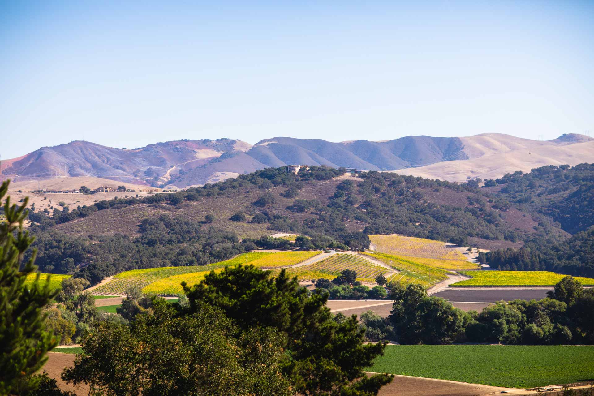
Edna Valley Hiking Trails Hiking
Mild weather and lush vineyards make Edna Valley a heavenly hiking destination on the coast. Showcasing one of the most temperate climates along Highway 1, expect nearly 70 degree temperatures all year round in Edna Valley. That said, wind along the Los Osos Valley area can pick up in the afternoon, so be prepared for a gusty picnic. Known for beautiful elevated trails, this location is best for moderate-to-skilled hikers.
Horizon Hike
Tolosa Winery leads a Horizon Hike over Edna Valley. Enjoy a mild hike, learn about the vines as you walk and take in a 360-degree view of the valley.

Cerro San Luis Trail
Cerro San Luis Obispo is the large morro looming over San Luis Obispo, stamped with a large letter “M.” It stands for Mission School, not Madonna Inn (which sits at its base) as many believe. The trail up this volcanic peak has great views of Laguna Lake and Bishop’s Peak. From the summit, there are views of San Luis Obispo, the Santa Lucia Mountains and peaks to Morro Bay.
Islay Hill
Located at the eastern end of the chain of volcanic plugs running across San Luis Obispo, Islay Hill is one of the easiest hikes of all of the area’s “seven sisters.” Traverse this dome-shaped, 776-foot summit for a workout with a view (you’ll gain 550 feet of elevation on the 1.8-mile loop). Along the way, keep an eye out for a junction leading to a steep, narrow trail that reveals fantastic views of the Santa Lucia Mountains.
Hiking all of Edna Valley
Click here to learn more about Edna Valley hiking and access a breakdown of each hiking trail available in the area. No need to wonder which is best for you or your family: We’ve collected all the necessary information on trailhead location, difficulty level and nearby points of interest. All you need to do is lace up your hiking boots and hit the trail.
Arroyo Grande Hiking Trails
Known for its timeless patchwork of farmland, orchards and vineyards, Arroyo Grande puts an agricultural twist on Highway 1 hiking. With weather nearly identical to Edna Valley (the two towns run parallel to each other), you’ll find easy-to-moderate trails winding along dense forested areas.
Trout Creek Trail
Looking for an equestrian-friendly trail? Trout Creek Trail in the Arroyo Grande Valley is almost 8 miles out and back and is well suited for horses and dogs. Enjoy listening to the creek and identifying a variety of birds on the moderate trail. Accessible March to November.
Hi Mountain Trail
Showcasing a variety of landscapes in a short distance, Hi Mountain Trail is unique. Located in the Santa Lucia Mountains just east of Lopez Lake, begin with an easy stream-side trail winding through dense woods. Follow the ridge, encountering a grassy viewing point with panoramic vistas. In total, the loop on Hi Mountain Trail is 3.25 miles round trip with 575 feet of elevation change. The trail is open to hikers with dogs, horses and mountain bikes.
Hiking all of Arroyo Grande
Click here to learn more about Arroyo Grande hiking and access a breakdown of each hiking trail available in the area. No need to wonder which is best for you or your family: We’ve collected all the necessary information on trailhead location, difficulty level and nearby points of interest. All you need to do is lace up your hiking boots and hit the trail.
Lopez Lake Trails
Outdoor enthusiasts flock to Lopez Lake for a reason: the climate is moderate year round and the lake’s recreation area encompasses 4,200 acres of open space and hiking trails. With scenic paths criss-crossing oak woodland and coastal sage scrub, this destination is home to black bears, mountain lions and mule deer. Many trails are directly accessible from Lopez Lake, although some–like the iconic Big Falls trail–require the use of a four-wheel drive vehicle.
High Ridge Trail
This trail passes a series of steep canyons east of Lopez Lake along a fire ridge. The hike offers scenic lake views and fossils can be found along the path and in the surrounding rock. The easy to moderate hike is 5 miles out and back, and is accessible year-round.
Big Falls Trail
Tucked away behind Lopez Lake lies Big Falls, one of the most scenic spots on the Central Coast. The two waterfalls along Big Falls Creek are some of the best around and worth the trek. To get to the trailhead, turn onto Hi Mountain Road, located just before the entrance to Lopez Lake Recreation Area, and then veer left onto Upper Lopez Canyon Road. The trail travels through a sycamore and oak forest to the 40-foot Lower Big Falls and, further up, 80-foot Big Falls.
Cougar Trail
The entrance for Cougar Trail lies near the entry to Lopez Lake Recreation Area. Close to 3 miles long, the trail welcomes hikers, dogs and mountain bikes. Enjoy scenic views, groves of oak trees and wildlife viewing.
Hiking all of Lopez Lake
Click here to learn more about Lopez Lake hiking and access a breakdown of each hiking trail available in the area. No need to wonder which is best for you or your family: We’ve collected all the necessary information on trailhead location, difficulty level and nearby points of interest. All you need to do is lace up your hiking boots and hit the trail.
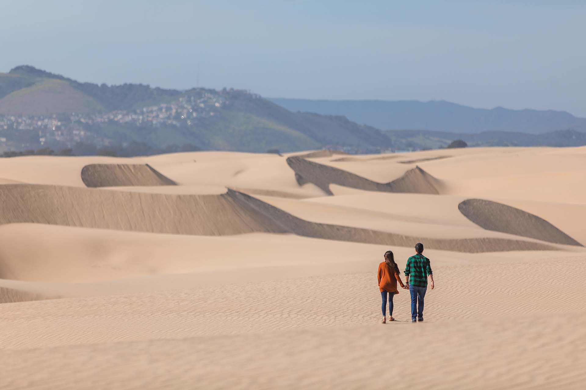
Oceano & Nipomo Hiking
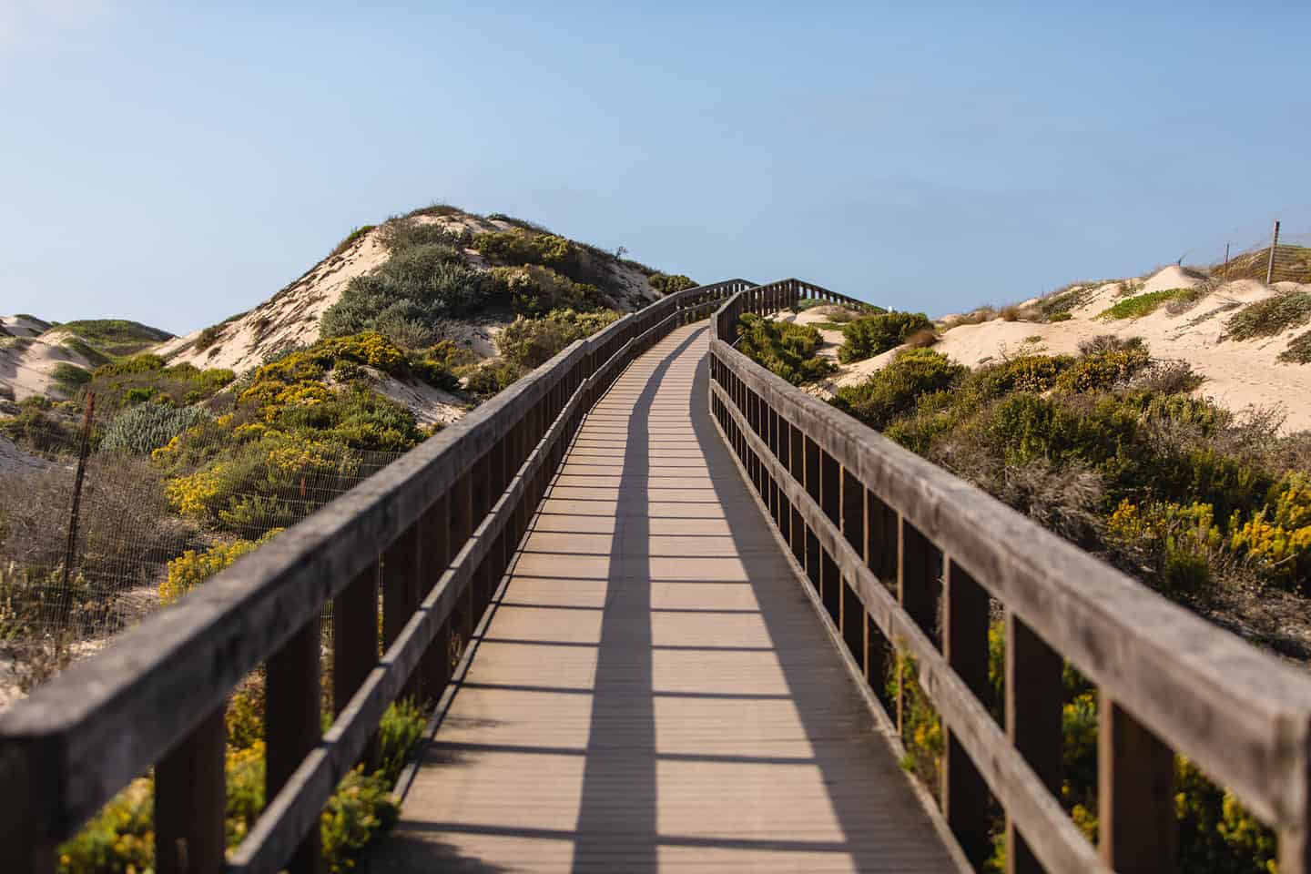
Oceano and Nipomo hiking trails beautifully represent the astounding geographical diversity of Highway 1. Enjoy a wide variety of trail scenery, from wooden boardwalks that allow hikers to walk across pristine lake waters to wide open expanses of undulating dunes. Along the way, keep an eye out for surfers, seabirds and fluttering Monarch butterflies.
Guadalupe-Nipomo Dunes
A trail from the Guadalupe-Nipomo Dunes Preserve to Mussel Rock spans 5.2-mile out and back. Hikers, trail runners and naturalists use the moderately difficult trail, which offers scenic coastal views.
To reach Oso Flaco, take Highway 1 south from Oceano and turn west onto Oso Flaco Lake Road and travel three miles until you reach the trailhead. To check out the Guadalupe-Nipomo Dunes Center, travel Highway 1 south to the small town of Guadalupe, where the road becomes Guadalupe Street. You’ll find the Dunes Center just past 11th Street.
Black Lake Trail
The Black Lake Trail in the Arroyo Grande Valley offers a 2-mile, easy to moderate out-and-back hike. Accessible year-round, the trail offers views of Black Lake. Hikers should note that the trail is currently only accessible via guided hikes hosted by Land Conservancy staff. A scheduled tour of the property reveals colorful wildflowers, impressive vistas and over-wintering Monarch butterflies.
Oceano Dunes Preserve Trail
Best known for the State Vehicular Recreation Area (SVRA), the Oceano Dunes Preserve also offers a quiet, uncrowded trail to walk. To reach the trailhead from southbound Highway 1, drive to Oceano (south of Pismo Beach and Grover Beach). Turn west on Pier Avenue and park at the entrance to the SVRA. Walk a half mile south, parallel to the water’s edge, to the dune entrance. You can also walk along Strand Way, a neighborhood street that parallels the beach. This reaches Arroyo Grande Creek, which also leads to the dune preserve entrance.
Nipomo Native Garden
This 0.6-mile trail stretches over a 12-acre botanical garden featuring plants native to the Nipomo Mesa Guadalupe Dunes complex. The trail travels through both developing and established woodland, with interpretive displays and kiosks throughout. The garden is used for recreation as well as research into plant community dynamics on the Nipomo Mesa. Open during daylight hours, the garden offers an easy hike plus benches from which to enjoy the view. The garden can be found between Pomeroy, Camino Caballo and Osage Streets in Nipomo, with parking available on Osage.
Hiking all of Oceano & Nipomo
Click here to learn more about Oceano and Nipomo hiking and access a breakdown of each hiking trail available in the area. No need to wonder which is best for you or your family: We’ve collected all the necessary information on trailhead location, difficulty level and nearby points of interest. All you need to do is lace up your hiking boots and hit the trail.